
LiDAR technology enables the data capture on field by lighting the target using pulsed laser. As LiDAR also provides elevation data, it finds applications in several industries.
Intelli Networks Infra Private Limited provides a wide range of LiDAR data processing services that helps in creating Digital Elevation Models (DEM), Digital Terrain Models (DTM) and Triangulated Inverse Networks (TIN) to provide highly accurate detail of the Earth’s surface. Intelli Networks Infra Private Limited LiDAR data processing services have helped global industries in taking informed decisions about their business. LiDAR data processing services enable the electrical utility industry with the efficient planning and maintenance of electric networks. LiDAR classification also gives a supporting hand to the agricultural sector, by watershed delineation and crop assessment mapping using LiDAR point cloud data. This way, LiDAR classification and LiDAR data processing assists many industrial sectors in planning and making informed decisions
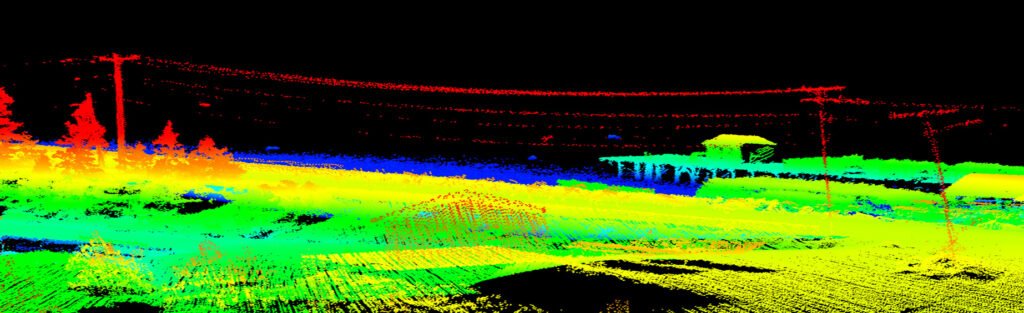
Intelli Networks Infra Private Limited offers professional Airborne and Terrestrial LiDAR services that help map physical features with very fine resolutions.

Airborne LiDAR Services
Mobile LiDAR Services
Intelli Networks Infra Private Limited offers Mobile LiDAR services to collect the following features:
- Building: Building canopy, Roof line and other man-made structures
- Transportation: Road, road cover line, Road curb etc.
- Transmission: Pylon, power line, light pole etc.
- Utility: Manhole, fire hydrants, poles (Road signs, Traffic poles, etc.).
- Vegetation: Single tree, tree canopy and bushes
- Land Planning and Visualization
- Railways
- Asset and Plant Inspections
- Engineering and Construction
- Powerline Inspections
Intelli Networks Infra Private Limited offers mapping of:
Following are the key domains where Intelli Networks Infra Private Limited UAV Services are employed for mapping and surveying:
- Mining and Natural Resources.
Typical LiDAR data processing services by Intelli Networks Infra Private Limited include:
Cadastral mapping is a comprehensive register of the details related to the property of an area. These details include the precise location, dimensions, and other geographical classifications of the properties or individual parcels of land. The maps generated using cadastral mapping services help in effective management of public land records. National and local governmental bodies, architecture and engineering firms, real estate developers, industries can uses the cadastral mapping services for making well informed decisions. Cadastral mapping services also enable to user to study additional details, such as survey district names, unique identifying numbers for parcels, certificate of title numbers, positions of existing structures, section or lot numbers and their respective areas, adjoining street names, selected boundary dimensions and references to prior maps.
Intelli Networks Infra Private Limited provides cadastral mapping for creation of cadastral maps from hard copies of the administrative maps with specific details of each plot, roads, railway lines, water bodies, vegetation, etc. These cadastral mapping service provide all inclusive solutions to land information system problems by focusing on various forms of land records.
In addition, Intelli Networks Infra Private Limited also provides the following services on LiDAR data
- Data cleansing and noise removal
- Bare Earth & non ground LiDAR classification
- Generation of DTM and contours
- Vectorization and feature extraction
- Image overlay and point cloud colorization